
my Chronicles from the Sprawl (19/n) - Edward Dean Adams Power Station
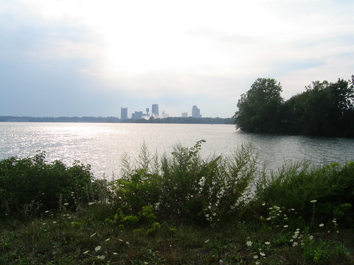
I have posted some scenic pictures of he Niagara fall before, but this one is different.
The fall are the far side of the water plane (Canadian Falls, 1/2 far left, Goat Island, 1/2 far right) , and we can not see then because we are at the level of the upper part. Canadian buildings, in the other side of the falls, are very visible in the far side though (the mist in the air, seen near the buildings, is the signature of the falls).
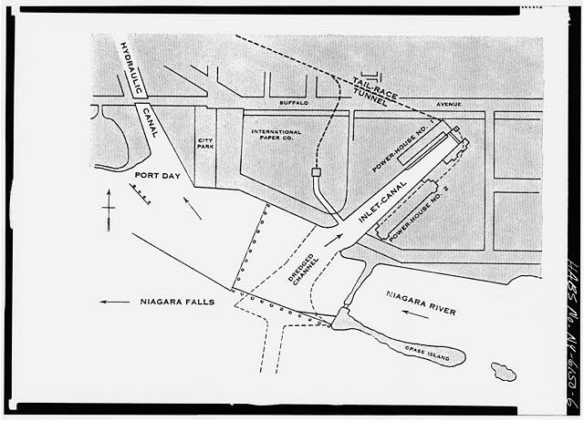
But the main interest of this picture is that it shows the entrance of the in-let canal for the former "Edward Dean Adams Station".
Build near the beginning of last century this was the turning point of the adoption of electricity as one of the main process of redistributing energy.
The place itself is quite abandoned and I had to use some old maps (also shown) and some math to find the place.
Satellite Photo (arrow in the place were I took the picture):
http://maps.google.com/maps?f=q&hl=en&q=43.078553,-79.046719&ie=UTF8&z=14&ll=43.078543,-79.046717&spn=0.031409,0.107975&t=k&om=1&iwloc=addr
Links:
http://freenet.buffalo.edu/bah/a/nf/adams/index.html
http://en.wikipedia.org/wiki/War_of_Currents
No comments:
Post a Comment